Hey there fellow drone enthusiasts! Ever found yourself daydreaming about soaring over breathtaking landscapes, capturing the essence of a place from a bird’s-eye view?
Well, you’re not alone! If you’re anything like me, you’ve probably typed into the search bar, “Best Places to Fly a Drone in Madagascar,” eagerly hoping to unlock the secrets of the island’s hidden gems from the sky.
Trust me; I’ve been there, and I get it the excitement, the curiosity, and that burning desire to capture Madagascar’s beauty from above. So, let me cut to the chase. After diving deep into the drone regulations, weather patterns, and the very soul of Madagascar, I’ve compiled the ultimate guide to satisfy your drone-flying wanderlust.
It’s not just about finding any spot; it’s about uncovering the hidden treasures, navigating the regulations, and ensuring you get the perfect shot every time.
This isn’t just a list; it’s a curated journey born out of passion and shared love for the art of photography. Ready for an adventure like no other? If you’re seeking the perfect blend of aerial thrill and stunning scenery, you’ve come to the right place.
This article is your ticket to the “9 Best Places to Fly a Drone in Madagascar.” So buckle up, fellow drone pilot, as we embark on a virtual tour of Madagascar’s most captivating locations.
Get ready to elevate your drone game and discover the unparalleled beauty of this island nation. Stick around, and let’s take your drone adventures to new heights!
Overview of Drone Laws in Madagascar

So, before we unleash our drones into the mesmerizing skies of Madagascar, it’s crucial to have a grasp of the ground rules.
The regulations surrounding drone usage can be like a maze, and navigating them ensures not only a breathtaking experience but also a legal and respectful one.
Key Regulations
Madagascar, like many countries, has its set of regulations for drone enthusiasts. Generally, drones are allowed for recreational use, but commercial use requires specific permits.
The key is to register your drone with the Civil Aviation Authority of Madagascar, ensuring that you comply with their airspace rules. Keep an eye on the altitude limits, typically capped at 150 meters, and be mindful of no-fly zones around sensitive areas like airports and military installations.
Understanding these regulations is not just about legality; it’s about respecting the country you’re exploring.
Adhering to Local Laws
Now, you might be thinking, “Do I really need to bother with all these rules?” The short answer is yes, and here’s why. Madagascar is not just a backdrop for your drone footage; it’s a vibrant country with a rich culture and diverse ecosystems.
Adhering to local laws isn’t just a legal obligation; it’s a way of showing respect to the communities and environments you’re capturing.
Respecting the rules ensures a positive experience for both you and the locals, fostering a harmonious relationship between drone enthusiasts and the beautiful island of Madagascar.
Violating Drone Laws
Okay, let’s talk about consequences. Violating drone laws in Madagascar isn’t a joke. Penalties can range from fines to confiscation of your drone equipment, and in severe cases, legal actions may be taken.
Now, I’m not trying to scare you off your drone adventure; I’m just emphasizing the importance of flying responsibly. It’s not just about protecting your gear; it’s about safeguarding the beauty of Madagascar for everyone.
So, let’s be rule-abiding drone pilots and ensure our aerial escapades leave nothing but admiration in their wake.
Also Read: Best places to Fly Drones in Luxembourg 2024
Factors to Consider Before Flying a Drone in Madagascar

Before we set our drones to dance with the winds over Madagascar, let’s dive into the essential factors that can make or break our aerial adventures.
From the whims of weather to the beating heart of cultural sensitivity, understanding these factors ensures our drones not only capture the beauty but do so with finesse and respect.
Weather Conditions
Picture this: your drone soaring through clear blue skies, capturing the lush landscapes of Madagascar. Beautiful, right? But before you launch, keep a keen eye on the weather forecast.
The island’s climate can be unpredictable, with sudden rain showers or gusty winds. Ensuring favorable weather not only safeguards your precious drone but guarantees the stunning shots you’re aiming for.
After all, no one wants their drone caught in a rain dance when it should be capturing the magic of Madagascar.
Local Cultural Sensitivities
Madagascar is not just a land of captivating scenery; it’s home to diverse and vibrant communities. Before sending your drone skyward, it’s crucial to respect local customs and sensitivities.
Seek permission from locals if you’re filming in populated areas and be mindful of cultural practices.
Drones buzzing overhead might be an everyday sight for you, but for the locals, it could be an intrusion.
Being culturally aware not only ensures smooth sailing for your drone but fosters a positive relationship between drone enthusiasts and the communities they’re capturing.
Environmental Impact and Conservation Efforts
Our passion for photo Photography comes with a responsibility – to minimize our impact on the environment.
Madagascar boasts unique ecosystems, from lush rainforests to arid landscapes. Be aware of any conservation efforts in the areas you plan to explore.
Avoid disturbing wildlife, steer clear of protected zones, and ensure your drone doesn’t contribute to environmental degradation.
Our drones can be ambassadors for responsible exploration, leaving only footprints of admiration in their pixelated wake.
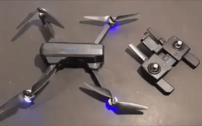
Drone Equipment and Technical Considerations
Now, let’s talk tech. Before you embark on your aerial odyssey, give your drone a thorough check. Are the batteries fully charged? Is your GPS working like a charm? Madagascar’s varied terrains demand a well-prepared drone.
Consider the technical aspects of your equipment, ensuring it’s up to the task. Don’t forget spare parts; Madagascar’s remote locations might not offer a quick pit stop for replacements.
A well-maintained drone isn’t just a reliable companion; it’s your ticket to capturing Madagascar’s wonders seamlessly.
Also Read: Best places to Fly Drones in Lithuania 2024
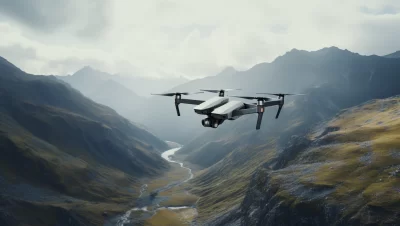
Best Places to Fly a Drone in Madagascar

Now, let’s unfold the map of Madagascar and pinpoint the first gem on our aerial journey – the iconic Avenue of the Baobabs.
Buckle up, drone enthusiasts, because this is where your bird’s-eye view will meet an extraordinary canvas of unique landscapes, legendary baobab trees, and the timeless allure of sunrise and sunset.
Prepare for a flight through not just nature’s wonders but also the echoes of cultural and historical significance that reverberate through this majestic avenue.
1. Avenue of the Baobabs

Nestled in the Menabe region, the Avenue of the Baobabs is a living testament to Madagascar’s natural grandeur. Your drone’s lens will dance with the towering baobab trees, creating a visual symphony of unique shapes and forms.
These ancient giants, some dating back over a thousand years, stand like sentinels, guarding the secrets of the island.
Capture the play of light and shadows during sunrise and sunset, transforming the landscape into a surreal spectacle.
Unique Landscape and Iconic Baobab Trees
As your drone hovers over the avenue, marvel at the surreal scenery below. The baobabs, also known as the “roots of the sky,” stretch their distinctive silhouettes towards the heavens, creating a panorama that’s both awe-inspiring and utterly Madagascar.
Each twist and turn of these ancient trees tells a story, a visual narrative waiting to be captured by your drone’s lens.
Sunrise and Sunset Shots
Now, picture this: the first rays of sunlight kissing the horizon, casting a warm glow on the baobabs. Or the sun bidding adieu, painting the sky in hues of orange and pink.
The Avenue of the Baobabs transforms during these golden hours, and your drone has a front-row seat to this celestial performance.
It’s not just about capturing a landscape; it’s about freezing a moment in time when nature herself becomes an artist.
Cultural and Historical Significance
Beyond the visual feast, the Avenue of the Baobabs resonates with cultural and historical significance. These ancient trees are more than just botanical wonders; they are part of the Malagasy heritage.
Locals believe that spirits inhabit these giants, adding a layer of mystique to the landscape. Your drone, hovering above, becomes a storyteller, capturing not just the physical beauty but the cultural essence that permeates this iconic avenue.
So, fellow drone pilot, get ready to etch a piece of Madagascar’s soul into your footage as you soar above the Avenue of the Baobabs.
2. Tsingy de Bemaraha National Park

Prepare for a drone flight like no other as you traverse the labyrinthine landscapes of Tsingy de Bemaraha.
The park, a UNESCO World Heritage Site, is a canvas of razor-sharp limestone formations, sculpted by nature into fantastical shapes.
Your drone becomes an artist, capturing the intricate details of this geological masterpiece from angles unimaginable on solid ground.
Dramatic Limestone Formations
As your drone ascends, the drama unfolds beneath its lens. The Tsingy, meaning “where one cannot walk barefoot,” lives up to its name.
Massive limestone pinnacles rise like ancient skyscrapers, creating a mesmerizing labyrinth of spires and canyons.
The interplay of light and shadow on these stone cathedrals adds a dynamic layer to the landscape, turning your drone footage into a visual symphony of nature’s artistry.
The Unique Landscape
Take a moment to appreciate the scale and grandeur of Tsingy de Bemaraha from the air. Your drone’s-eye perspective unveils the vastness of the park, showcasing the intricate network of limestone needles and the lush greenery that thrives within.
The aerial views not only provide a breathtaking spectacle but also offer a fresh understanding of the park’s geological complexity and ecological richness.
Wildlife and Biodiversity
Now, let’s talk about the lively inhabitants of this stone kingdom. Your drone becomes a silent observer of the park’s diverse wildlife and rich biodiversity.
From lemurs leaping between limestone spires to vibrant birdlife adorning the treetops, Tsingy de Bemaraha is a sanctuary of nature’s wonders. Capture these moments from above, respecting the park’s regulations to ensure minimal disturbance to the inhabitants.
Your drone, in the hands of a responsible pilot, becomes a portal to the vibrant life thriving within Tsingy de Bemaraha National Park. Get ready to document not just rocks and formations, but the living, breathing heart of Madagascar’s wild beauty.
3. Ranomafana National Par

Get ready to navigate the skies above one of Madagascar’s ecological treasures. Ranomafana, meaning “hot water” in Malagasy, promises not only a thermal treat but a visual feast for your drone.
Let’s soar above the emerald canopy and crystal-clear streams, where the drone’s hum harmonizes with the symphony of nature.
Lush Rainforest and Diverse Flora
As your drone ascends, the rainforest canopy unfolds like a vast, green tapestry. Ranomafana is a haven for biodiversity, and your drone’s lens becomes a passport to this hidden world. Capture the diverse flora, from ancient ferns to towering canopy trees.
Navigate through the intricate network of vines and witness the ever-changing hues of green that paint the landscape. Your drone’s-eye view allows you to appreciate the intricacies of this living, breathing ecosystem.
Waterfalls and Natural Beauty
Prepare for a breathtaking spectacle as your drone hovers over Ranomafana’s cascading waterfalls.
The park is adorned with these natural wonders, each providing a moment of serenity and awe. Capture the graceful descent of water, the rainbows in the mist, and the lush surroundings that frame these liquid masterpieces.
Ranomafana’s waterfalls are not just landmarks; they are poetry in motion, waiting to be composed by your drone’s camera.
Respectful Drone Usage in a Protected Area
Here’s where responsibility takes center stage. Ranomafana National Park is a protected area, and as drone enthusiasts, it’s our duty to ensure minimal impact.
Respect the park’s guidelines and regulations, fly at a safe distance from wildlife, and avoid disturbing the natural rhythm of the ecosystem. Your drone isn’t just a tool for exploration; it’s a guardian of Ranomafana’s beauty.
So, let your flights be a dance of admiration, leaving nothing but a fleeting hum in the air and memories preserved in pixels. Fly responsibly, and let Ranomafana unfold its wonders through the lens of your drone.
Also Read: Best places to Fly Drones in Liechtenstein 2024
4. Isalo National Park

Isalo, a geological masterpiece, awaits your drone’s eye view. This is not just a flight; it’s a journey through canyons, over sandstone sculptures, and into the heart of oases. Get ready for a visual narrative that unfolds with every beat of your drone’s rotors.
Canyons, Sandstone Formations, and Oases
As your drone takes flight, the canyons of Isalo reveal their intricate dance with time. Towering walls of rock, sculpted by wind and water, form a natural amphitheater that beckons exploration.
Navigate through these canyons, capturing the interplay of light and shadow on the rugged surfaces.
From there, ascend to capture the sandstone formations, where gravity seems to negotiate with the rocks, creating gravity-defying sculptures. Finally, explore the oases nestled within the park – lush pockets of greenery that stand in contrast to the arid landscape.
Your drone is not just a spectator but a storyteller, revealing the geological tale etched in Isalo’s rocks and the resilient life thriving in its hidden corners.
Varied Topography for Dynamic Drone Footage
Isalo National Park is a playground for topographic diversity. From the high plateaus to deep canyons, the park offers a dynamic canvas for your drone footage.
Experiment with angles and altitudes, capturing the ever-changing terrain beneath. The varied landscapes provide endless opportunities for creative shots, making each flight a new chapter in your visual exploration of Isalo. So, let your drone dance through the diverse topography, telling a story that goes beyond words.
Capturing the Essence of the Park
Now, for the secret sauce. To truly capture the essence of Isalo, consider the time of day. The warm hues of sunrise and sunset cast a magical glow on the rocks, creating a cinematic ambiance.
Play with shadows and highlights, emphasizing the textures of the canyons and the contours of the sandstone formations. Patience is key; let your drone linger over the landscapes, allowing the natural beauty to unfold.
Lastly, be mindful of the park’s regulations, ensuring that your flights contribute to the appreciation and preservation of Isalo’s extraordinary charm.
As your drone hovers above Isalo National Park, remember: you’re not just capturing scenes; you’re encapsulating the spirit of a geological wonder.
So, let your flights be a celebration of the park’s grandeur, leaving a trail of awe-inspiring footage in the wake of your drone’s propellers.
5. Andasibe-Mantadia National Park

This park, a symphony of green and a sanctuary for diverse life forms, invites your drone to become an artist on the canvas of its dense rainforests. As we take flight, let’s capture not just the visuals but the very heartbeat of Andasibe-Mantadia.
Dense Rainforest and Unique Wildlife
Prepare for a sensory overload as your drone ascends into the heart of Andasibe-Mantadia’s dense rainforest.
The thick canopy, a mosaic of shades, conceals a world teeming with life. Your drone’s lens becomes a window into this thriving ecosystem.
Capture the lush foliage, the play of light filtering through the leaves, and, if you’re lucky, the glimpses of unique wildlife.
The call of lemurs and the rustle of unseen creatures become part of the soundtrack to your drone journey.
Remember to maintain a respectful distance to avoid disrupting the park’s inhabitants and to adhere to regulations that safeguard their habitat.
Water Features and Scenic Spots
As your drone navigates through the rainforest, discover the hidden gems of Andasibe-Mantadia. Water features, from cascading waterfalls to serene streams, add a dynamic layer to the landscape.
Let your drone hover above these scenic spots, capturing the dance of water against the backdrop of lush greenery.
Experiment with angles and perspectives to showcase the harmony between the flowing waters and the surrounding flora. Each frame becomes a postcard, a testament to the park’s natural beauty.
Adhering to Regulations in Protected Areas
While the allure of Andasibe-Mantadia is undeniable, responsible drone usage is paramount. The park is a protected area, and your flights should align with regulations aimed at conserving its delicate ecosystems.
Prioritize the protection of wildlife habitats, respect no-fly zones, and fly at altitudes that minimize disturbance.
Remember, your drone isn’t just a tool for exploration; it’s a guardian of Andasibe-Mantadia’s ecological balance. By adhering to regulations, you ensure that future generations can experience the same wonders that unfold beneath your drone’s lens.
So, as you embark on your drone journey through Andasibe-Mantadia National Park, let each flight be a celebration of biodiversity, a visual ode to the rainforest’s richness.
Your drone, in the right hands, becomes a storyteller, weaving a narrative that extends beyond the frames into the very soul of this protected sanctuary.
6. Amber Mountain National Park

As your drone takes flight over Amber Mountain, the juxtaposition of volcanic formations and vibrant greenery creates a visual tapestry that demands to be captured.
This is more than a journey; it’s an immersion into the geological and ecological diversity that defines Amber Mountain National Park.
Volcanic Landscapes and Lush Greenery
Rising from the earth, the volcanic landscapes of Amber Mountain unfold beneath your drone’s lens.
Capture the rugged beauty of ancient lava flows, the unique contours of volcanic craters, and the lush vegetation that thrives in this dynamic environment.
As your drone hovers over the undulating terrain, each frame becomes a canvas, blending the raw energy of volcanic history with the serenity of a green haven. Consider different altitudes to showcase the intricate details of this geological symphony.
Lakes and Waterfalls
Now, let your drone dance with the waters of Amber Mountain. Lakes shimmer like sapphires, and waterfalls cascade in graceful descent. Your drone becomes a choreographer, orchestrating a visual ballet over these aquatic features.
Experiment with angles to capture the reflections in the lakes and the play of light on the waterfalls.
These liquid landscapes are not just picturesque; they are moments frozen in time, waiting to be immortalized by your drone’s lens.
Drone Use Near Sensitive Ecosystems
As we marvel at the beauty of Amber Mountain, let’s tread lightly. The park is home to sensitive ecosystems, and responsible drone usage is paramount.
Respect no-fly zones, maintain a safe distance from wildlife, and avoid flying over fragile habitats. consider the ecological impact of your flights and prioritize the preservation of Amber Mountain’s natural balance.
Your drone, when flown with mindfulness, becomes a tool for appreciation rather than disruption, allowing future generations to experience the same awe-inspiring landscapes.
As you navigate the skies above Amber Mountain National Park, let each flight be a celebration of nature’s resilience and an affirmation of responsible exploration.
Your drone, capturing the essence of this volcanic oasis, becomes a storyteller weaving tales of geological drama and ecological harmony. So, soar high, but do so with a keen eye for the delicate balance that makes Amber Mountain a living masterpiece.
Also Read: Best places to Fly Drones in Libya 2024
7. Nosy Be Island

As your drone lifts off the ground, Nosy Be Island unveils itself as a haven of sun-kissed shores, vibrant underwater worlds, and communities that add a human touch to this tropical tapestry.
This is not just a flight; it’s a visual symphony that captures the essence of Nosy Be from a perspective only drones can provide.
Coastal Scenery and Pristine Beaches
Your drone becomes a virtual seagull as it glides over the coastal landscapes of Nosy Be. Capture the intricate coves, golden sandy beaches, and the turquoise hues of the Indian Ocean.
Adjust your altitude to showcase the meeting point of land and sea, where waves caress the shore.
Nosy Be’s coastal scenery is a palette of colors, and your drone’s lens is the brush that paints a picture of tropical paradise.
Marine Life and Coral Reefs
Dive into the underwater wonders as your drone hovers above the marine playground surrounding Nosy Be. Coral reefs come to life beneath the clear waters, home to a vibrant array of marine life.
Let your drone be an underwater explorer, documenting the ballet of fish, the dance of corals, and the hidden treasures of the ocean floor.
Ensure your flights adhere to marine conservation guidelines, respecting the delicate ecosystems that thrive below the surface.
Respecting Privacy and Local Communities
While capturing the beauty of Nosy Be, it’s crucial to respect the privacy of its communities. Fly responsibly, avoiding intrusive flights over homes and private spaces.
Consider the cultural sensitivity of the island’s residents, seeking permission if necessary and flying at a distance that preserves their privacy. Nosy Be is not just a visual spectacle; it’s a living community, and your drone flights should contribute positively to the harmony between visitors and locals.
As your drone pirouettes over the paradisiacal landscapes of Nosy Be, let each flight be a testament to the delicate balance between natural beauty and human habitation.
Your drone, when wielded with respect and mindfulness, becomes a bridge between the enchanting vistas and the communities that call Nosy Be home.
So, fly high, capture the magic, but do so with a conscious eye towards preserving the island’s charm for generations to come.
8. Ankarafantsika National Park

As your drone ascends above the landscape of Ankarafantsika, it becomes a silent witness to the intricate dance of nature from the dry deciduous forests to the avian symphony that echoes through the park. This is a visual odyssey that seeks to capture the essence of Ankarafantsika from the sky.
Dry Deciduous Forests and Lakes
Navigate your drone through the tapestry of dry deciduous forests that define Ankarafantsika. Capture the unique beauty of deciduous trees, their foliage transitioning with the seasons.
As your drone glides over the landscape, discover the lakes that dot the park, reflecting the vibrant hues of the surrounding flora.
Adjust your altitude to reveal the intricate patterns and textures of the forests, creating a visual narrative of the delicate balance between arid and verdant.
Birdwatching Opportunities
Ankarafantsika is a haven for birdwatchers, and your drone is the perfect tool to join the avian spectacle.
Fly your drone to vantage points that offer a bird’s-eye view of the park, providing opportunities to capture the winged residents in their natural habitat.
Keep a respectful distance to avoid disturbing the birds, and let your drone’s camera become an extension of your binoculars, immortalizing the diverse bird species that call Ankarafantsika home.
Best Times and Locations for Drone Flights
Timing is everything, especially when it comes to drone flights in Ankarafantsika. Early mornings and late afternoons provide the ideal lighting conditions, casting a warm glow on the forests and lakes.
Explore locations with significant biodiversity, such as the edges of the lakes or the transition zones between different habitats. Keep an eye on weather conditions, ensuring that your flights coincide with clear skies for optimal visibility and image quality.
As your drone weaves through the skies above Ankarafantsika, let each flight be a celebration of the park’s biodiversity and natural splendor. Your drone, in the role of a visual storyteller, captures the essence of this unique ecosystem.
So, fly with reverence, capturing moments that contribute to the collective awe and appreciation of Ankarafantsika National Park.
9. Antsiranana (Diego Suarez)

As your drone takes to the skies over Antsiranana, the Bay unfolds like a visual symphony, historical sites tell tales of the past, and urban landscapes reveal the heartbeat of the city. Let your drone be the storyteller as we capture the diverse facets of Antsiranana from above.
Bay of Diego Suarez and Surrounding Landscapes
The Bay of Diego Suarez is the jewel in the crown of Antsiranana, and your drone has a front-row seat to this coastal spectacle.
Soar above the bay, capturing the unique formations and shades of blue that characterize the waters. Explore the surrounding landscapes, from lush greenery to rocky outcrops.
Your drone becomes a painter, translating the panoramic views into frames that showcase the natural beauty of Diego Suarez.
Historical Sites and Urban Areas
Take your drone on a historical journey as it hovers over the significant sites that dot Antsiranana.
Fly above the remnants of Fort Diego, capturing the echoes of a bygone era. Transition to urban areas, exploring the bustling streets, markets, and architectural wonders.
Adjust your altitude to unveil the intricate details of historical landmarks and the vibrant pulse of the city.
Your drone’s lens becomes a time-traveling storyteller, juxtaposing the old and the new in the evolving narrative of Antsiranana.
Flying Drones in Urban Environments Responsibly
Urban flights demand a heightened sense of responsibility. Respect privacy, adhere to local regulations, and prioritize safety. Fly at safe altitudes, avoiding crowded areas and ensuring your drone doesn’t disrupt the daily rhythm of urban life.
Consider the cultural sensitivity of the city’s residents, seeking permissions when necessary. Your drone, in urban settings, is not just a tool for exploration; it’s an ambassador that represents the responsible and respectful side of drone piloting.
As your drone glides through the skies over Antsiranana, let each flight be a celebration of the city’s diversity, both natural and cultural.
Your drone, when flown responsibly, becomes a bridge between the past and the present, the natural and the urban.
So, capture the essence of Antsiranana with each flight, leaving behind a visual legacy that echoes the spirit of this captivating city.
Also Read: Best places to Fly Drones in Liberia 2024
Final Thoughts on the Best Places to Fly a Drone in Madagascar

As we wrap up our aerial journey over Madagascar, the canvas of landscapes beneath our drones has painted a visual symphony.
Let’s take a moment to recap the best places to fly, emphasize the importance of responsible drone usage, and encourage the preservation of Madagascar’s beauty through respectful exploration.
From the iconic Avenue of the Baobabs to the dramatic landscapes of Tsingy de Bemaraha, the lush rainforests of Ranomafana, the surreal canyons of Isalo, the marine wonders of Nosy Be, the volcanic beauty of Amber Mountain, the avian haven of Ankarafantsika
and the vibrant cityscape of Antsiranana – Madagascar’s diverse tapestry has unfolded beneath our drones. Each location is a chapter in the visual story of this enchanting island, a story told from the skies.
Amidst the awe-inspiring landscapes, let’s not forget the responsibility that comes with flying drones. Respect the regulations in each location, whether in protected areas, urban landscapes, or marine ecosystems.
Prioritize safety, adhere to altitude guidelines, and be mindful of the impact on wildlife. By flying responsibly, we become stewards of Madagascar’s beauty, contributing to its preservation for generations to come.
Madagascar’s allure is not just in its physical beauty but in the coexistence of its communities and the delicate balance of its ecosystems.
Let’s encourage the drone community to capture and share the magnificence of Madagascar, fostering appreciation for its unique landscapes, wildlife, and cultures.
However, let this encouragement be a call for responsible sharing – respecting the privacy of communities, adhering to cultural sensitivities, and contributing positively to the ongoing conservation efforts.
As our drone blades come to a rest, let’s carry the spirit of responsible exploration forward. Madagascar’s beauty is both a privilege and a responsibility to preserve.
So, fellow drone enthusiasts, let each flight be a celebration of this natural wonder, a dance with the winds that leaves no trace but everlasting awe.
Fly high, fly responsibly, and let Madagascar’s beauty echo through your lenses and in the hearts of those who witness your aerial odyssey.