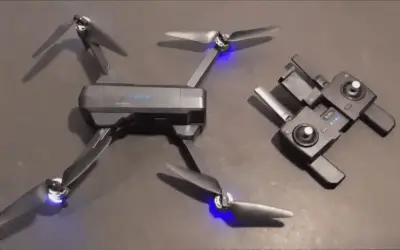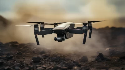
Hey there, fellow drone enthusiasts! I know the feeling when you’re up in the sky with your drone, capturing breathtaking aerial views, and you want that perfect shot or precise survey data.
You start wondering, “How can I maintain a steady altitude without constantly adjusting the controls?” Well, you’ve come to the right place. If you’re searching for insights on altitude hold in drones, you’re in for a treat.
You see, I’ve been on quite the journey researching altitude hold systems in drones. It’s all about that magical technology that lets your drone hover at a consistent height, making your flying experience smoother and your aerial tasks more precise.
Through my exploration and countless hours of studying, I’ve unearthed the secrets behind this essential feature. And I’m excited to share it all with you. So, buckle up, my fellow drone enthusiasts, because I’ve got the answers you’re looking for.
If you’re eager to discover how altitude hold works in drones, you’re in the right place. In the following sections of this article, I’ll break down the components, explain the principles, and unveil the real-world applications of altitude hold in drones.
Whether you’re a hobbyist, a professional, or just someone curious about drone technology, this article will provide you with the knowledge you need. So, keep reading, and let’s dive into the fascinating world of altitude held in drones.
Basics of Altitude Hold
let’s dive right into the nitty-gritty of altitude hold in drones. It’s the foundation of smooth and controlled flight, and it all begins with understanding the basics.
Definition of Altitude Hold
Altitude hold, in its simplest form, is like the drone’s autopilot for maintaining a consistent height above the ground or a reference point. Picture it as that trusty co-pilot who ensures your drone doesn’t soar too high or dip too low.
What it does is use a combination of sensors and algorithms to keep your drone steady at the altitude you desire.
Think of it as the cruise control in your car. When you’re driving, you set a specific speed, and cruise control maintains it without you constantly pressing the gas pedal.
Similarly, altitude hold maintain your drone at a specific height without you continuously adjusting the controls. This is incredibly handy, especially when you want to focus on capturing that perfect aerial shot or conducting precision surveys.
Constant Altitude is Essential for Various Drone Applications
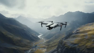
Now, you might wonder, why is this constant altitude thing so crucial. Well, imagine you’re an aerial photographer trying to capture a stunning landscape. You want every shot to be perfectly aligned, with consistent altitude.
Altitude hold ensures that your drone stays at the exact height you set, allowing you to concentrate on framing the shot and not worrying about altitude changes.
But it’s not just photography; altitude plays a vital role in various drone applications. For surveying, mapping, and inspections, maintaining a consistent altitude is paramount to gathering accurate data.
Whether you’re mapping terrain or inspecting power lines, altitude holds ensure that your measurements are precise, without altitude fluctuations throwing off your calculations.
Comparison to Manual Altitude Control and Its Limitations
Now, let’s briefly touch on manual altitude control. Sure, you can fly a drone without altitude hold, but it’s like driving a car without cruise control on a hilly road. You’ll constantly need to adjust the throttle to keep the drone at the right height.
Not only is this tiring, but it’s also less precise. Human hands can’t maintain the same altitude as effectively as a well-tuned altitude hold system.
Manual control is prone to fluctuations due to environmental factors like wind, which makes your drone bob up and down. Plus, it requires your constant attention.
Imagine trying to capture a smooth, cinematic video with those altitude fluctuations—it’s a recipe for frustration.
Altitude hold, on the other hand, offers that hands-free, rock-solid stability that’s crucial for various drone applications.
The Components of Altitude Hold Systems
Now, let’s unravel the inner workings of altitude hold systems in drones. It’s a bit like peering under the hood of a car to understand how the engine works.
We’ll explore two key components that make altitude hold possible: the Barometric Pressure Sensor and the PID Controller.
Barometric Pressure Sensor
Barometric Pressure Sensor: Imagine you have a little meteorologist on board your drone—it’s the barometric pressure sensor. This tiny device is the key to measuring altitude. Here’s how it works.
How Barometric Pressure Sensors Work
Barometric pressure sensors are like the altimeters used in airplanes. They detect changes in atmospheric pressure as your drone ascends or descends. As you rise in altitude, the air pressure decreases, and the sensor records this drop.
Conversely, as you descend, the pressure increases. This change in pressure is used to estimate your drone’s height above sea level or as a reference point.
Think of it as a scuba diver’s depth gauge. When a diver descends into the ocean, the pressure increases with depth.
Similarly, as your drone climbs, the pressure decreases with altitude. The barometric pressure sensor serves as your drone’s altitude gauge, helping it maintain the desired height.
Role in Measuring Drone Altitude Above Sea Level or a Reference Point
The beauty of barometric pressure sensors lies in their ability to provide a reference point. They measure the atmospheric pressure at your current location and compare it to a known standard, typically sea level pressure.
This comparison allows the sensor to estimate your drone’s altitude above sea level accurately.
Think of it as using a barometer to check the weather. It tells you whether the pressure is high (clear skies) or low (possibly rainy).
Similarly, the barometric pressure sensor tells your drone how high it is above sea level, enabling precise altitude control.
PID Controller
PID Controller: Now that we’ve got altitude measurement sorted, let’s talk about the brain behind altitude hold: the PID controller. It’s like the autopilot that ensures your drone maintains that perfect height.
The PID Control Algorithm
PID stands for Proportional-Integral-Derivative, but don’t let the name scare you. At its core, it’s a control algorithm that fine-tunes your drone’s throttle to keep it at the desired altitude. Let’s break down what those fancy words mean.
Detailed Breakdown of the Proportional, Integral, and Derivative Components
- Proportional (P): This component responds to the immediate error, essentially how far off your drone’s altitude is from the desired height. If it’s too high, the P component reduces throttle; if it’s too low, it increases throttle.
- Integral (I): The I component looks at the accumulated past errors and corrects any long-term deviations. It’s like smoothing out those occasional bumps in the road.
- Derivative (D): The D component anticipates future errors by considering the rate of change of error. It helps dampen altitude fluctuations, ensuring your drone maintains a steady height.
How PID Controllers Are Used in Altitude Hold
Think of the PID controller as your drone’s altitude butler. It constantly assesses the altitude error and adjusts the throttle accordingly to keep your drone flying at the perfect height.
It’s this combination of sensors and algorithms that makes altitude hold not just a feature but an art form in drone technology.
Feedback Loop
Feedback Loop: Now, let’s explore the role of the feedback loop in altitude hold systems. Think of it as a dynamic dance between your drone and the sensors, all while keeping it steady in the sky.
The Closed-Loop System in Altitude Hold
Imagine you’re trying to balance a pencil on the tip of your finger. If it starts leaning one way, you immediately adjust it to keep it upright.
That’s essentially what the closed-loop system in altitude hold does. It continuously monitors your drone’s altitude using the barometric pressure sensor and compares it to your desired height.
This feedback loop ensures that if your drone drifts even slightly from the set altitude, corrective action is taken. It’s a bit like a self-correcting GPS system. If your drone strays off course, it quickly gets back on track to maintain that perfect height above the ground or reference point.
Continuous Adjustment Based on Sensor Feedback
The real magic happens when your drone uses the feedback from the barometric pressure sensor to make continuous adjustments. It’s like having a co-pilot who’s always watching the altitude gauge and gently tweaking the throttle to keep your drone on course.
Whether it’s a gust of wind or a minor altitude fluctuation, the feedback loop ensures your drone remains rock-steady at the desired height.
Picture this: you’re cycling uphill, and the terrain keeps changing. You instinctively adjust your pedaling speed to maintain a constant effort, not too fast and not too slow.
Similarly, the feedback loop in altitude hold keeps your drone’s throttle just right to maintain a constant altitude, no matter what the conditions are like up there.
Safety Features
Safety Features: Now, let’s talk about safety in altitude hold systems. It’s not just about keeping your drone in the right place; it’s also about ensuring everything stays within safe limits.
Altitude Limits and Their Importance
Altitude limits act like a guardian angel for your drone. These are predefined boundaries that prevent your drone from flying too high or too low.
Why is this crucial? Well, exceeding the maximum altitude limit can lead to legal issues and potential conflicts with other airspace users like airplanes. On the other hand, flying too low might risk collisions with obstacles or even pedestrians.
Think of it like a leash for your drone. You wouldn’t want your furry friend to wander off into dangerous territory. Altitude limits serve a similar purpose, keeping your drone safely within bounds while you focus on your aerial tasks.
Fail-Safes to Prevent Extreme Altitude Deviations
Imagine your drone encounters a glitch or loses communication with the controller while it’s in the air. It’s a nerve-wracking situation, but altitude hold systems have your back.
They come equipped with fail-safe mechanisms that kick in when something goes awry. These fail-safes can force your drone to return to a safe altitude or even initiate a safe landing.
Think of it as your car’s airbags. You hope you never need them, but they’re there to protect you in case of an accident.
Fail-safes in altitude hold systems provide that extra layer of security, ensuring your drone won’t go rogue if unexpected issues arise during your flight.
How Altitude Hold Works Step by Step
Now, let’s take a journey through the step-by-step process of how altitude holds in drones work. It’s a bit like the choreography of a well-rehearsed dance, where every move is in perfect harmony.
Initialization and Reference Point
Initialization and Reference Point: Just like you need a starting point for any journey, altitude hold starts with initialization and setting a reference point.
Setting the Initial Altitude Reference
Imagine you’re on a hike, and you want to measure your progress. You set a marker at the trailhead as your reference point. Similarly, when you power up your drone, you need to tell it where the starting altitude is.
You do this by setting an initial reference point, either by manually inputting the desired altitude or using the default reference. This tells the drone, “This is where we begin, maintain this altitude.”
Measurement
Measurement: Now that we’ve set the stage, let’s talk about measurement—the drone’s way of keeping tabs on its height above the ground or reference point.
Barometric Pressure Sensor to Measure Current Altitude
Think of the barometric pressure sensor as your drone’s altitude gauge. As your drone ascends, the sensor detects a drop in atmospheric pressure, and as it descends, the pressure increases.
Just like you’d check a barometer to anticipate weather changes, the sensor measures these pressure variations to estimate your drone’s altitude. It’s a bit like having a mini meteorologist on board, constantly updating your drone on its height.
Error Calculation
Error Calculation: With the measurement in hand, it’s time to calculate the error—the difference between where your drone is and where you want it to be.
Difference Between Desired and Actual Altitudes
Think of it as setting a target for a basketball shot. If you aim for the hoop and the ball goes above or below, you calculate the difference between where it landed and where you wanted it to go.
Similarly, in altitude hold, the system calculates the error by subtracting the desired altitude from the actual altitude measured by the barometric pressure sensor. This error tells the drone how far off it is from the perfect height.
PID Controller Action
PID Controller Action: Now, the PID controller takes center stage. It’s like the conductor of an orchestra, orchestrating the throttle’s movements to correct the altitude.
Adjusting Throttle Based on PID Control Algorithm
Think of the PID controller as your drone’s altitude butler. It assesses the error calculated earlier and decides how much to adjust the throttle. If the drone is too high, it reduces the throttle; if it’s too low, it increases the throttle.
It’s a bit like adjusting your car’s speed when driving downhill or uphill to maintain a constant pace. The PID controller ensures that your drone’s throttle is just right to keep it flying at the desired altitude.
Continuous Monitoring
Continuous Monitoring: Altitude hold is all about maintaining that perfect height, so it needs to be on the lookout for any deviations.
How the System Continually Monitors and Adjusts Altitude
Imagine you’re riding a bicycle on a bumpy road. You instinctively adjust your balance to stay upright. Similarly, the altitude hold system continually monitors the drone’s altitude and makes adjustments as needed.
If your drone encounters wind or minor disturbances, it swiftly corrects its height, ensuring that your aerial experience remains smooth and steady.
Benefits of Altitude Hold in Drones
Altitude hold isn’t just a fancy feature; it’s a game-changer in the world of drones. Let’s explore how this technology brings a whole array of benefits to the table.
Precision and Stability
Precision and Stability: Picture trying to paint a masterpiece while riding a roller coaster. Not ideal, right? Altitude hold provides the steady canvas you need for precision and stability.
How Altitude Hold Enhances Flight Stability and Accuracy
Imagine you’re trying to take a picture of a moving target from a shaky platform. It’s nearly impossible to capture that perfect shot.
Altitude hold eliminates those wobbles and jitters, making your drone a stable platform for photography, videography, or any task that demands precision. It’s like having a tripod in the sky.
Your drone hovers steadily, ensuring each shot is as sharp as it can be. Whether you’re filming a cinematic masterpiece or conducting detailed inspections, altitude hold gives you the stability you crave.
Photography and Videography
Photography and Videography: For all the aerial photographers and videographers out there, altitude hold is your golden ticket to capturing breathtaking shots.
Importance of Consistent Altitude for Capturing Quality Images and Footage
Imagine you’re framing the perfect shot—a sweeping landscape, a dazzling sunset, or a sprawling cityscape. The last thing you want is your drone bobbing up and down, ruining the scene.
Altitude hold ensures that each frame is consistent, each pan is smooth, and each video is cinematic. It’s like having a crane in the sky, giving you the freedom to capture stunning visuals with ease.
With altitude hold, you can focus on your creative vision, knowing that your drone will maintain the perfect height for that picture-perfect shot.
Mapping and Surveying
Mapping and Surveying: Altitude hold isn’t just for photographers; it’s a game-changer in fields like mapping and surveying.
How Altitude Holds Aids in Surveying and Mapping Applications
Imagine you’re tasked with mapping a vast, rugged terrain. It’s a daunting job, but altitude hold simplifies it. By maintaining a consistent altitude, your drone can fly precise patterns, collecting accurate data for mapping and surveying.
It’s like having a highly skilled surveyor who can effortlessly cover vast areas, ensuring your measurements are spot on. Altitude hold doesn’t just save time; it enhances the accuracy of your data, making it invaluable for various industries.
Ease of Use
Ease of Use: Now, let’s talk about accessibility. Altitude hold makes drone operation a breeze, especially for those new to the game.
Making Drone Operation More Accessible, Especially for Beginners
Imagine you’re learning to ride a bike, and you have training wheels to keep you steady. Altitude hold serves a similar purpose for beginners. It takes the complexity out of maintaining altitude, allowing you to focus on mastering the controls and getting comfortable with flying.
It’s like having a safety net during your early flights, ensuring your drone stays at a manageable height.
Whether you’re a hobbyist or a newbie exploring the world of drones, altitude hold is your trusty companion, making your flying experience smoother and more enjoyable.
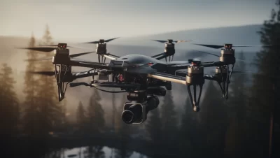
Real-world Applications
Now, let’s get down to the exciting part—real-world applications of altitude hold in drones. It’s time to see how this technology steps out of the theoretical and into the practical.
Photography and Videography
Photography and Videography: For photographers and videographers, altitude hold is like a secret ingredient that takes your work to the next level.
How Altitude Hold Benefits Aerial Photographers and Videographers
Imagine you’re capturing an outdoor wedding, and you want to capture the grandeur of the venue from above. Altitude hold ensures that your drone hovers steadily at the desired height, allowing you to frame each shot with precision.
It’s like having your own flying camera assistant, making sure every shot is a masterpiece. Whether you’re shooting weddings, commercials, or documentaries, altitude hold turns your drone into a reliable tool for stunning visuals.
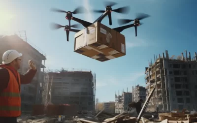
Agriculture
Agriculture: In the world of farming, precision is everything, and altitude hold brings that precision to a whole new level.
The Use of Drones with Altitude Hold in Precision Agriculture
Imagine you’re a farmer, and you need to monitor your crops to ensure they’re thriving. Altitude hold enables your drone to fly at a consistent height while capturing detailed images of your fields.
This data can help identify crop stress, pest infestations, or irrigation issues early on, allowing for timely interventions. It’s like having a high-tech scout that can cover acres in minutes, providing insights that can significantly boost crop yields while conserving resources.
Search and Rescue
Search and Rescue: In high-stakes situations like search and rescue missions, altitude hold becomes a crucial tool.
How Altitude Holds Aids in Search and Rescue Missions
Imagine you’re part of a search and rescue team looking for a lost hiker in a vast forest. Altitude hold ensures your drone can maintain a steady altitude, even in challenging terrain. This stability is essential for conducting effective aerial searches and using thermal imaging cameras to spot heat signatures. It’s like having an extra set of eyes in the sky, helping you locate missing persons more efficiently and potentially saving lives.
Environmental Monitoring
Environmental Monitoring: Environmental researchers and conservationists rely on accurate data, and altitude holds offer a helping hand.
Applications in Environmental Research and Monitoring
Imagine you’re studying a remote wildlife habitat or tracking changes in a fragile ecosystem. Altitude hold allows your drone to fly consistently at a set height, making it easier to capture consistent data.
Whether you’re monitoring wildlife populations, tracking deforestation, or studying climate change, altitude holds to ensure that your drone provides reliable and precise measurements.
It’s like having a trusty research assistant in the sky, helping you gather the critical data needed for environmental protection and conservation efforts.
Tips for Using Altitude Hold Effectively
Now that you know the ropes of altitude hold, it’s time to dive into some pro tips to make the most of this fantastic feature. Think of it as the secret to unlocking its full potential.
Calibrating Sensors
Imagine you’re setting up your guitar for a perfect performance. Just like your instrument needs tuning, your drone’s sensors need calibration.
Before taking off, always ensure your barometric pressure sensor is calibrated correctly. Calibration ensures accurate altitude readings, which are crucial for altitude hold to function correctly.
It’s like making sure your compass points north before embarking on a journey. Proper calibration ensures your drone knows precisely where it is in relation to the ground or reference point, allowing altitude hold to work its magic seamlessly.
Understanding Environmental Factors
Picture yourself going for a run on a hot summer day. You’d drink more water, right? Similarly, understanding environmental factors is essential when using altitude hold.
Factors like wind speed, temperature, and air pressure can affect your drone’s performance. It’s like dressing appropriately for the weather. If it’s windy, altitude hold might need to work a bit harder to keep your drone steady.
If it’s hot, the air might be thinner, affecting altitude measurements. Being aware of these environmental variables helps you anticipate how altitude holds will respond and make necessary adjustments for a smooth flight.
Monitoring Battery Life
Imagine you’re on a cross-country road trip, and you need to keep an eye on your gas gauge. Similarly, monitoring your drone’s battery life is crucial when using altitude hold.
Altitude hold relies on power to keep your drone at the desired height. As your battery depletes, altitude hold might become less effective. It’s like driving with a nearly empty tank; you can’t go as far.
Always keep an eye on your battery level and plan your flight accordingly. Ensure you have enough juice to maintain altitude and return home safely.
Adhering to Local Regulations
Imagine you’re driving through different states with varying speed limits. Just like you follow local traffic laws, adhere to local drone regulations.
Different regions have specific rules about where and how high you can fly your drone. Always research and follow these regulations to avoid legal issues. Altitude hold can make it tempting to soar to new heights, but it’s essential to stay within the boundaries set by local authorities.
It’s like respecting speed limits on the road; it ensures your flights are safe and legal, giving you peace of mind while you enjoy the benefits of altitude hold.
Final Thoughts on Altitude Hold in Drones
So, what is altitude hold in drones? It’s the unsung hero that keeps your drone at the perfect height, no matter what challenges it faces.
It’s the technology that turns your drone into a stable platform for photography, videography, and a host of other applications.
It’s the reason you can explore the skies with confidence, knowing that your drone will stay right where you want it to be. Altitude hold isn’t just a fancy feature; it’s a game-changer. It brings precision, stability, and ease of use to your drone operations.
It’s the reason why aerial photographers can capture breathtaking shots, farmers can monitor their fields with precision, and search and rescue teams can conduct more effective missions. It’s a tool that empowers you to explore the skies and unlock new possibilities.
If you haven’t already delved into altitude hold, now’s the time. Whether you’re a seasoned drone enthusiast or just starting your journey, altitude hold can elevate your drone experience. It’s like having a trusty co-pilot who ensures your drone remains steady and reliable.
So, go ahead, explore altitude hold, and discover the world of possibilities it opens up for your drone adventures. The sky’s the limit, and altitude holds help you reach it with ease. Happy flying!
Frequently Asked Questions on Altitude Hold-In Drones
What is altitude hold in drones, and how does it work?
Answer: Altitude hold in drones is a technology that allows the drone to maintain a constant altitude above the ground or a reference point without manual control. It works by using a barometric pressure sensor to measure changes in air pressure and calculate the drone’s altitude. A PID (Proportional-Integral-Derivative) controller then adjusts the drone’s throttle to keep it at the desired height. This closed-loop system continuously monitors and corrects altitude, ensuring stable flight.
Why is altitude Hold important for drone users?
Answer: Altitude hold is crucial for drone users because it enhances flight stability and precision. It allows for steady and accurate aerial photography, videography, and other applications. It simplifies drone operation, making it accessible to beginners. Moreover, altitude hold is essential for safety, preventing drones from flying too high or too low, which could lead to legal issues or collisions.
What are the benefits of using altitude hold in drones for photography and videography?
Answer: Altitude holds significant advantages for photographers and videographers. It ensures stable and smooth flight, resulting in high-quality images and footage. With altitude hold, drones can maintain a consistent altitude while capturing breathtaking aerial views, making it a valuable tool for professionals and hobbyists alike.
Can altitude hold be useful in fields beyond photography, like agriculture and search and rescue?
Answer: Absolutely, altitude hold has diverse applications. In agriculture, it aids in precision farming by providing consistent altitude for crop monitoring and data collection. In search and rescue missions, altitude holds help drones maintain a steady altitude, making it easier to conduct aerial searches and locate missing persons efficiently. It’s versatile technology with a wide range of real-world uses.