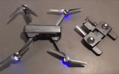
Hello, drone enthusiasts! Welcome to my review of the best photogrammetry drones for mapping and surveying in 2024.
I understand how difficult it can be to map and survey an area manually without employing photogrammetry. That can be tedious as hell. You’ll have to walk days on end trying to cover every possible area so you don’t miss anything.
If you’re one of those people, I got you covered. I’ve compiled a list of the best photogrammetry drones for mapping and surveying that would solve your problems.
These drones are quite expensive but they’re durable, have a very high camera quality, a long battery life, a long-range transmitter, a gimbal to stabilize the camera, and a high payload capacity.
The DJI Phantom 4 RTK is the best Photogrammetry drone for mapping and surveying. However, it’s quite pricey but it has a 4K Ultra HD camera, long battery life, long flight time, and obstacle avoidance mode which gives you a fun flight and a good user experience overall.
Here is a quick summary of all the best photogrammetry drones for mapping and surveying I’ve hand-picked for you after my research.
Quick Summary of the Best Photogrammetry Drones For Mapping and Surveying
- Quick Summary of the Best Photogrammetry Drones For Mapping and Surveying
- How I Selected The Best Photogrammetry Drones For Mapping and Surveying
- What Are The Best Photogrammetry Drones?
- What Are The Best Photogrammetry Drones For Mapping?
- What Are The Best Photogrammetry Drones For Surveying?
- What To Look For in a Photogrammetry Drone For Mapping and Surveying
- Final Thoughts on the Best Photogrammetry Drones For Mapping and Surveying
How I Selected The Best Photogrammetry Drones For Mapping and Surveying
I read lots of posts on Reddit, Quora, and other drone forums to cut through the noise and pick the best photogrammetry drones for mapping and surveying. I also watched lots of YouTube videos and read through hundreds of product reviews on Amazon to come up with this list.
This article took me about 19 hours of research to ensure you get the best quality for your money’s worth.
Some of the factors I took into consideration when selecting the best photogrammetry drone for mapping and surveying include wind resistance, resistance to multiple crashes, 4K camera, long battery life, and special features that make it easy to use like RTK feature, high payload capacity, and more.
What Are The Best Photogrammetry Drones?

Here, I’ll dive into the top 7 best photogrammetry drones.
Each review will contain the features and benefits of the products, the pros and cons, the specifications, and my final verdict on the product.
This section aims to help you make a smooth and easy decision about which drones suit your needs and your budget.
1. DJI Phantom 4 RTK (Best Overall Photogrammetry Drone)

The DJI Phantom 4 RTK is my best photogrammetry drone. It’s a high-quality drone that can be used for both mapping and surveying thanks to its RTK feature, which makes it a reliable drone on the market.
The RTK module located at the top of the drone in conjunction with the D-RTK2 ground station that can collect data in 3D format distinguishes the Phantom 4 RTK from the standard Phantom 4.
However, it still shares many similarities with the standard Phantom 4, like the 3-axis gimbal, the 1-inch CMOS sensor, and the 5870 mAh battery that gives the drone a 30-minute flight time.
The improved controller for the Phantom 4 RTK also has a hot-swappable battery, a microSD card slot for survey data storage and an option for 4G connectivity for cloud-based backup.
For mapping missions, the RTK’s flying time of 30 minutes is sufficient. For mapping applications, the 7-kilometer range is enough. The drone can fly in challenging settings because of its greater range.
A wide area may be mapped quickly at 36 mph. The finest image quality is provided by the 1 CMOS sensor camera, which records 20 MP photos and 84-degree field video.
Even automobiles may fit in the 350 mm size. It weighs 1391 grams, making it easy to handle if you need to transfer it.
DJI Phantom 4 RTK Specifications
- Weight: 1375 grams
- Dimensions Folded (without propellers): 221×96.3×90.3 mm (L×W×H)
- Dimension Unfolded (without propellers): 347.5×283×107.7 mm (L×W×H)
- Diagonal Length: 350 mm
- Max Ascent Speed: 6 m/s
- Max Descent Speed: 4 m/s
- Max Horizontal Speed: 45 mph
- Max Takeoff Altitude: 6000 m
- Max Flight Time: 30 minutes
- Max Hovering Time: 30 minutes
- Max Flight Distance: 30 km
- Max Wind Speed Resistance: 10 m/s (Level 6).
- Photo Resolution: 4K: 4096 X 2160
- Video Resolution: 4K Ultra HD: 4K: 4096 X 2160@50 fps
- Max Video Bit Rate: 100 MBPS
- Video Transmission System: DJI O2
- Battery Capacity: 5870 mAh
- Battery Charging Time: Over 1 hour
- Max Charging Power: 160 W
- File Storage: micro SD card (256 GB max)
What Are The Best Photogrammetry Drones For Mapping?
Here, I’ll dive into the top 3 best photogrammetry drones for mapping.
Each review will contain the features and benefits of the products, the pros and cons, the specifications, and my final verdict on them.
This section aims to help you make a smooth and easy decision about which drones suit your needs and your budget.
2. DJI Matrice 300 (Best Mapping Drone)

The DJI Matrice 300 is one of the best drones for mapping. It has impressive flight time, speed, range, and a high-quality camera. However, it’s also one of the most expensive drones on the market.
The DJI Matrice 300 comes with a large battery and powerful motors that give it a long flight time of 55 minutes, which is long enough for you to carry out your aerial mapping without any interruptions.
The drone’s 15 km range enables it to cover wide regions without being concerned about losing connectivity. The quickest speed at which it can cover huge regions rapidly and more effectively is 23 m/s.
The DJI Matrice 300 and Zenmuse P1 are the finest options if you want the greatest configuration.
The Zenmuse P1 is a full-frame camera mounted on a 3-axis gimbal. Without ground control points, it can build models with up to 3 cm level precision and features a worldwide mechanical shutter. The drone’s size and extremely expensive price are really its main drawbacks.
The 960P camera is stabilized by a gimbal to prevent blurry images, coupled with a large weight of 3.6 kg.
DJI Matrice 300 Specifications
- Weight: 930 grams
- Dimensions Folded (without propellers): 221×96.3×90.3 mm (L×W×H)
- Dimension Unfolded (without propellers): 347.5×283×107.7 mm (L×W×H)
- Diagonal Length: 350 mm
- Max Ascent Speed: 6 m/s
- Max Descent Speed: 4 m/s
- Max Horizontal Speed: 45 mph
- Max Takeoff Altitude: 6000 m
- Max Flight Time: 30 minutes
- Max Hovering Time: 30 minutes
- Max Flight Distance: 30 km
- Max Wind Speed Resistance: 10 m/s (Level 6).
- Photo Resolution: 4K: 4096 X 2160
- Video Resolution: 4K Ultra HD: 4K: 4096 X 2160@50 fps
- Max Video Bit Rate: 100 MBPS
- Video Transmission System: DJI O2
- Battery Capacity: 5870 mAh
- Battery Charging Time: Over 1 hour
- Max Charging Power: 160 W
- File Storage: micro SD card (256 GB max)
3. Autel Robotics EVO II PRO (Best Mapping Drone)

The Autel EVO II Pro V3 offers up to 6K footage at faster frame rates with improved noise suppression and dynamic range. With the F/2.8-F/11 variable aperture, 16x digital zoom, and 44000 maximum ISO, photographers have more creative freedom.
With the Autel EVO 2 Pro V3, you may enjoy your favorite moments while you’re flying, without the need for post-processing because 6K mobile time-lapse videos can be exported immediately after being captured, and JPEG and RAW formats are also supported.
The Autel EVO II Pro V3 has been improved with SkyLink 2.0 video transmission technology, which permits video transmission up to 15 kilometers away and at an image quality of 2.7K.
For the best anti-interference performance, the video transmission supports tri-band 2.4 GHz, 5.8 GHz, and 900 MHz communication and can automatically frequency hop.
The V3 camera’s ISO ranges up to 44000 for night shooting thanks to Autel’s newest Moonlight Algorithm 2.0 feature.
Additionally, 12-bit DNG images, which have 64 times the color rendering capabilities of 10-bit (EVO 2 Pro V2) and the ability to capture up to 68.6 billion colors, provide the pilot with more post-production versatility.
Autel Robotics EVO II PRO Specifications
- Takeoff weight: 2.63 lbs (1191 g)
- Dimensions (L*W*H): 9.1*5.1*4.3 inches (folded);
- Dimensions (L*W*H): 18*22*4.3 inches (unfolded)
- Max service ceiling altitude: 7000 m
- Max flight distance: 25 km
- Max flight time: 40 min
- Max resistance to wind: 27mph, 12 m/s (Take-off and landing)
- Sensor: 1 inch CMOS; 20M pixels
- Aperture: f/2.8 – f/11
- Zoom: 1-16x (up to 3x lossless zoom)
- Battery weight: 365 g
- Battery charging time: 90 minutes
- Max Transmission Distance: FCC: 9.3 miles (15 km); CE: 5 miles (8 km)
- Display screen: 2340×1080 60fps
- Sensing system type: Omnidirectional sensing system
- Video format: MP4 / MOV (MPEG-4 AVC/H.264, HEVC/H.265)
- Supported file system: FAT32/exFAT
4. Parrot Anafi (Best Mapping Drone)

The Anafi is a fantastic drone for everyday use. It can be taken almost everywhere because of its compact size. Its lengthy flight duration and range allow you to cover a vast area without worrying about signal loss or running out of power.
It takes 25 minutes to fly the drone. For small, lightweight drones in particular, this is a good flight time.
The videos are fluid and distinct. The big sensor allows for improved video and picture capture. This makes it possible to take photos even in low light or at night. The Anafi is a compact drone that is easy to transport. It is one of the lightest drones on the market, with a weight of 320 g.
The Parrot Anafi can cover a distance of 4 kilometers thanks to its range. It is a very fast drone, with a speed of 15 m/s. Keep an eye on drones because their quick flights might be a little risky.
And don’t let it soar too close to anything or anyone. The Anafi can capture photos in 16 quality and videos in 4K resolution.
Parrot Anafi Specifications
- Size folded: 244x67x65mm
- Size unfolded: 175x240x65mm
- Weight: 320g
- Max transmission range: 4km with controller
- Max flight time: 25 min
- Max horizontal speed: 15m/s (55km/h)
- Max vertical speed: 4m/s
- Max wind resistance: 50km/h
- Service ceiling: 4500m above sea level
- Operating Temperature range: -10°C to 40°C
- Satellite Positioning Systems: GPS & GLONASS
- Video Resolution (4K Cinema): 4096×2160 24fps
- Video Resolution (4K UHD): 3840×2160 24/25/30fps
- Video Resolution (FHD): 1920×1080 24/25/30/48/50/60fps
- Video HFOV: 69°
- Max video bitrate: 100 Mbps
- Video format: MP4 (H264)
- Photo Resolution (Wide): 21MP (5344×4016) / 4:3 / 84° HFOV
- Photo Resolution (Rectilinear): 16MP (4608×3456) / 4:3 / 75.5° HFOV
- Photo formats: JPEG, Adobe DNG (RAW)
- HDR: 4K UHD video
- Battery capacity: 2700mAh
- Battery life: 25 min
- Charging port: USB-C
- Voltage: 7.6V
- WMax Charging power: 24W
What Are The Best Photogrammetry Drones For Surveying?
Here, I’ll dive into the top 3 best photogrammetry drones for surveying.
Each review will contain the features and benefits of the products, the pros and cons, the specifications, and my final verdict on them.
This section aims to help you make a smooth and easy decision about which drones suit your needs and your budget.
5. DJI Inspire 2 (Best Surveying Drone)

The DJI Inspire 2 is a professional-grade drone with top-notch performance. Professional drone pilots can also make use of these drones because they can be used for both surveying and photography.
The footage is stable and fluid thanks to the 3-axis gimbal stabilization technology. Any collision is avoided by the obstacle avoidance system.
It has an amazing flying time of 27 minutes, which gives you enough time to survey the area.
For the majority of drones, a range of 7 km is more than adequate. The range of 7 kilometers makes it possible to cover a large area without losing connectivity with the controller. The DJI Inspire 2 can travel at a maximum speed of 94 km/h, making it one of the fastest drones.
It works well for people who wish to take rapid pictures. The fast speed is particularly appreciated by long-range pilots since it allows them to cover a lot of ground in a short period of time.
This drone is intended for seasoned photographers with top-notch cameras. While the drone lacks a camera, it is compatible with a wide range of cameras.
It’s one of the best photogrammetry drones for surveying; it’s a big drone with a diagonal dimension of 23.8 inches. It is somewhat heavier due to its 3440 grams weight.
DJI Inspire 2 Specifications
- Weight: 3440 grams
- Dimensions Folded (without propellers): 221×96.3×90.3 mm (L×W×H)
- Dimension Unfolded (without propellers): 347.5×283×107.7 mm (L×W×H)
- Diagonal Length: 350 mm
- Max Ascent Speed: 6 m/s
- Max Descent Speed: 4 m/s
- Max Horizontal Speed: 45 mph
- Max Takeoff Altitude: 5000 m
- Max Flight Time: 30 minutes
- Max Hovering Time: 30 minutes
- Max Flight Distance: 30 km
- Max Wind Speed Resistance: 10 m/s (Level 6).
- Photo Resolution: 4K: 4096 X 2160
- Video Resolution: 4K Ultra HD: 4K: 4096 X 2160@50 fps
- Max Video Bit Rate: 100 MBPS
- Video Transmission System: DJI O2
- Battery Capacity: 5870 mAh
- Battery Charging Time: Over 1 hour
- Max Charging Power: 160 W
- File Storage: micro SD card (256 GB max)
6. FreeFly Alta X (Best Surveying Drone)
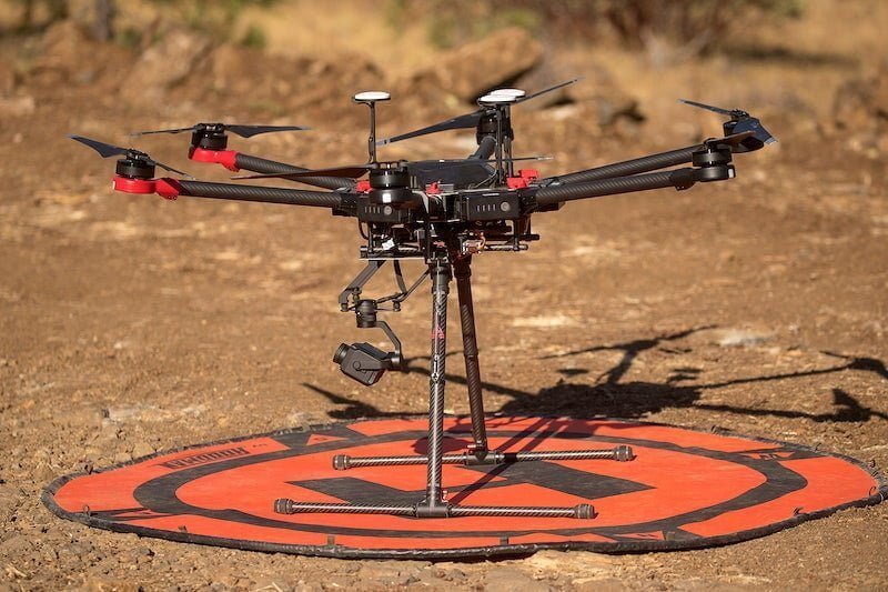
The Freefly Alta X is a top-tier drone that is ideal for mapping and surveying. It is designed primarily for filmmaking and comes with a free-flying gimbal that provides steady and dependable operation.
Videos shot by the free-flying Alta X aren’t wobbly. The 50-minute flying duration and strong batteries were built for lengthy journeys.
For individuals who wish to stay in the air for longer periods of time, the drone’s flight time is a perfect option. The 10 km range is sufficient for mapping over long distances without losing connection.
It moves at 72 mph, which is fast enough to go around but slow enough to maintain stability. The strong motors ensure you don’t miss anything while keeping up with traffic.
The camera isn’t present, but it is compatible with other cameras. This drone is not portable at all. It is great for aerial photography.
However, the drone doesn’t come with a camera, but it has a space for attaching a camera to the body.
Freefly Alta X Specifications
- Qty 1 – Alta X Airframe with 30A isolators, F9P GPS
- Qty 2 – Fuse Mini 297 32V 10A
- Qty 2 – Replacement Battery Strap
- Qty 2 – Active Blade Bumper (black)
- Qty 2 – Active Blade Bumper (gray)
- Qty 5 – M4x16 Combo Head bolt
- Qty 5 – M4x10 Combo Head bolt
- Qty 5 – M3x8 Combo Head bolt
- Qty 5 – M4x14 Combo Head bolt
- Qty 5 – M4x8 Combo Head bolt
- Qty 1 – USB C to A Cable (1m)
- Qty 1 each – 2.0mm, 2.5mm, and 3mm allen drivers
7. DJI Mavic 3 (Best Surveying Drone)

The DJI Mavic 3 is one of the best photogrammetry drones for surveying. Its 46-minute flight time is the longest of all the drones on this list. You can spend more time in the air without worrying about charging.
The range of the DJI Mavic 3 has been upgraded to 15 km thanks to the O3+ transmission system.
Not only is the battery unique, but its dual camera is also an absolute beast! It has a Hasselblad 4/3” sensor and a ½” Tele camera sensor that has a 28x hybrid zoom. This gives you high-quality minute details of your pictures when taken from afar or at a high altitude.
You can shoot videos in 5.1K at 50 fps. Not only that, but you can also shoot 4K videos at 120 fps!
DJI Mavic 3 Specifications
- Weight: 895 grams
- Dimensions Folded (without propellers): 221×96.3×90.3 mm (L×W×H)
- Dimension Unfolded (without propellers): 347.5×283×107.7 mm (L×W×H)
- Diagonal Length: 380.1 mm
- Max Ascent Speed: 6 m/s
- Max Descent Speed: 6 m/s
- Max Horizontal Speed: 15 m/s
- Max Takeoff Altitude: 6000 m
- Max Flight Time: 46 minutes
- Max Hovering Time: 40 minutes
- Max Flight Distance: 30 km
- Max Wind Speed Resistance: 12 m/s (Level 7)
- Photo Resolution: 20 MP: 5280 X 3956
- Video Resolution: 4K Ultra HD: 5120×2700 @50 fps
- Max Video Bit Rate: 200 MBPS
- Video Transmission System: DJI O2
- Battery Capacity: 5000 mAh
- Battery Charging Time: 1 hour
- Max Charging Power: 65 W
- File Storage: micro SD card (256 GB max)
What To Look For in a Photogrammetry Drone For Mapping and Surveying

There are many factors that will determine the type of photogrammetry drone to purchase. You must carefully assess some particular factors to develop the right judgment about each drone, then select the model that best suits your individual requirements.
There are many types of photogrammetry drones on the market. But here are some major factors to consider when making a purchase for the best photogrammetry drones for mapping and surveying:
Drone Price
Be ready to splash thousands of dollars on a photogrammetry drone for mapping and surveying. These types of drones are normally more expensive than beginner and recreational drones.
If you want to get your money’s worth out of your drone, don’t buy one for less than $500. Drones below that price tag may not have some of the premium features you need for commercial use.
The sweet spot for photogrammetry drones is around $5000. Within this price range, you can get a high-quality drone that’s durable and has features that will suit your professional needs.
You can also check out the best cheap drones for every budget.
Drone Size
The size and weight of a drone are important factors to look out for when buying a commercial drone. Photogrammetry drones for mapping and surveying are generally bigger and heavier because they would need to carry a big battery that would give you a long flight time.
Plus, they may need to carry some load based on your commercial needs.
You can also read about the best drones under 250 grams in 2024.
Camera Quality
Having a high-quality camera on your drone is something every commercial pilot needs because you’ll be required to capture some photos or videos based on your client’s requests and more.
At a minimum, you need a drone with at least a 2K camera. Going for anything less would neither give you nor your clients the satisfaction derived from your photograph or video.
The sweet spot of the camera resolution for a photogrammetry drone for mapping and surveying is normally around 4K resolution. That quality is enough for them to capture footage in decent quality.
Some drones include FPV view transmission capabilities, which will let you watch what’s occurring in the air in real time. You’ll be able to fly the plane using an iOS or Android app if it supports mobile control.
If you decide to purchase a drone with a camera, be sure to educate yourself about the drone laws in your country to prevent you from breaking the law.
You should check out the best camera drones for photography and videography.
Flight Speed
The speed of the drone will depend on what type of mapping and surveying you want to use it for.
Photogrammetry drones for mapping and surveying are generally fast, and the majority of them come with triple-speed mode so you can regulate the speed based on your personal preference.

Flight Range
Most photogrammetry drones for mapping and surveying should be able to go a long distance without losing connection with the remote controller.
The general range for photogrammetry drones for mapping and surveying is between 5 km and 15 km.
You should keep this factor in mind when creating a budget for your photogrammetry drone. You should take your time to check out the features of the drones to know what you’re getting.
You can check out the best drones for long distances if you want a drone that can travel far without losing connection with the remote controller.
Flight Time
Drones in general don’t have a long battery life compared to other remote-controlled devices. Cheaper drones will always have a shorter battery life than more expensive drones.
This happens because cheap drones tend to be small and long-lasting batteries tend to be big. Big batteries won’t fit into small drones. Hence, the need for small batteries with short battery lives.
This isn’t all doom and gloom; the majority of photogrammetry drones for mapping and surveying can achieve a flight time of around 30 to 45 minutes, depending on the drone. You can extend the flight time by flying at a low speed or buying an extra battery if your drone has a detachable drone.
You can check out the best drones with long flight times if you want a drone with long battery life.
Mechanical Shutter
A drone with a mechanical shutter should be your first priority if you are professionally mapping with drones. Almost any drone may be used to produce drone models, but if it lacks a mechanical shutter, the quality will drop, and mapping the region will take significantly longer.
When using a standard shutter, the camera lens is exposed to light one line at a time. If the drone is moving as the shot is being taken, this results in a blur. Mechanical shutters, in contrast, expose the entire shutter at once to capture a picture.
Drone Durability
Well, cheaper drones won’t be able to withstand wear and tear like other expensive drones. Cheaper drones are easily damaged and more likely to be blown away by the wind.
You can reduce the frequency of repairs by either purchasing a drone with propeller guards to protect the propellers from damage or purchasing a propeller guard for your drone if it has a spot for attaching the propeller guard.
Availability of Spare Batteries
Most drones on this list have spare batteries, so you can spend more time flying them when recharging the extra batteries. More often than not, drones with this price tag tend to come with extra batteries.

Ease of Use
Drones that are relatively easy to fly make the flying experience easy and less stressful. The drones on this list come with one-push autonomous features that let the drone take off, land, or return to base with the push of a button.
RTK Feature
The most crucial component for mapping with UAVs is navigation. With this turned on, your drone may maneuver more precisely by switching from the low-accuracy GPS that other drones use to real-time kinematic GPS.
Propellers
You don’t need to change the propellers as frequently since bigger propellers last longer and can handle heavier weights.
Long-Range Transmitter
Depending on the type of mapping and surveying drone, the ground controller needs a long-range radio link with the drone for greater control. For instance, you’ll need a long-range transmission if you wish to map sizable areas or make 3D models.
Gimbal
A gimbal stabilizes the camera during flight, which is necessary for taking crystal-clear, distortion-free pictures and videos.
Payload Capacity
This is speaking of the weight that a drone can transport. This should weigh at least 2-3 pounds if you’re using your drone for mapping and surveying, which is enough to transport a 4K camera and a gimbal for stabilization. For mapping and surveying purposes, several sensors may be attached to the drone.
Warranty
Warranty is an important factor when selecting the best drones to purchase. Your drone needs to be covered by a warranty so you can get it repaired or replaced when something goes wrong with it within the time limits of the warranty.
Availability of Replacement Parts
Your drone should come with easy access to other parts and accessories that need to be replaced after damage. The best drones often have an abundance of spare parts that are easily accessible at a moment’s notice to the drone pilots if something goes wrong.
Other Features
The majority of photogrammetry drones will have some special features that make them convenient to fly like collision detection, GPS, obstacle detection, camera stabilization, and many more.
In summary, think carefully about what you want before you go shopping for a drone.
Final Thoughts on the Best Photogrammetry Drones For Mapping and Surveying
We’ve come to the end of the road on the best photogrammetry drones for mapping and surveying in 2024
The DJI Phantom 4 RTK came out as my first choice on this list. It has everything you need for a photogrammetry drone for mapping and surveying. It has a 4K camera, GPS, gimbal stabilization, long flight time, long-range, RTK function, and many more
You won’t go wrong with it if you choose to go for it.
Can’t seem to find what you’re looking for? Check out my comprehensive list of the best drones for the year. It contains many drones for different categories and purposes.
Don’t forget to share this article with your friends and other drone enthusiasts on social media using the share button below, telling them what you have learned here today!